
Surveying Lab
Surveying is the process of determining relative positions of different objects on the surface of the earth by measuring horizontal distances between them and preparing a map to any suitable scale. Measurements are taken in horizontal plane only. Surveying is the art of determining the relative positions of points on, above or beneath the surface of the earth by means of direct or indirect measurements of distance, direction and elevation. Levelling is a branch of surveying the object of which is to find the elevations of points with respect to a given or assumed datum and to establish points at a given elevation or at different elevations with respect to a given or assumed datum. Survey is performed to prepare a map of relative positions on surface of the earth. It shows the natural feature of a country such as towns, villages, roads, railways, etc. They may also include details of different engineering works such as bridge, canal, dam etc. Before commencement of any major engineering project, survey is carried out to determine the location of site and its surrounding. To understand the topography of the site and natural resource availability. Survey is carried out to prepare the cadastral map showing property boundaries.
The surveying lab of TKM College of Engineering is committed socially in providing economically viable solutions in this area. The objectives of various surveys conducted in surveying lab are contour levelling and positioning of existing details, topographic survey of project location, checking the level and slope of project area, develop facilities to cultivate research interest among students and faculties and disseminate knowledge to the research community.
The Surveying lab is presently utilized for the conduct of lab classes for the undergraduate programme in Civil Engineering. The lab is effectively utilized by undergraduate students and faculties for carrying their final year dissertation work in various branches of Civil Engineering and funded research works respectively. The lab also undertakes consultancy works for various private agencies, and is an approved consultancy centre for central and state government.
Strength of the labFollowing are the strength of the lab
- a) Lab space of 800ft2 .
- b) Facilities available in the lab are in par with the requirements of the university prescribed laboratory course.
- c) Facilities for conducting consultancy works for various private agencies and central and state government
- d) Faculties with expertise in advanced surveying equipments.
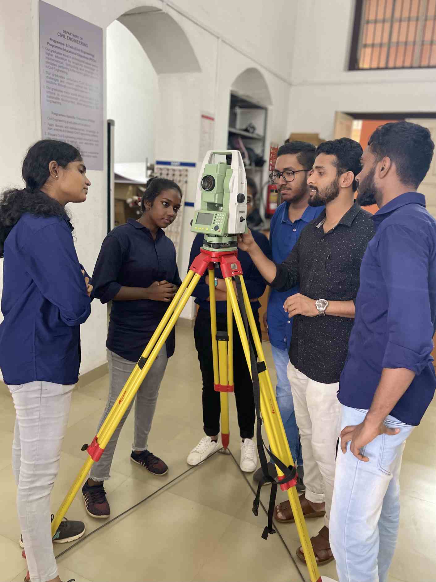
The Surveying Laboratory is equipped with facilities for conducting topographic surveying, contour levelling and positioning of existing details, checking the slope of the project areas. The Laboratory is fully equipped for the conduct of regular experiments at UG level and consultancy works.
Equipments available in the lab| Major Instruments | |||||
|---|---|---|---|---|---|
| SI.No | Name of the Instrument | Model | No. | Year | Year of purchasing |
| 1 | GPS | Megellar Hand field GPS | 1 | 25000 /- | 15/05/2004 |
| Garmin GPS etrex10 | 1 | 9690 /- | 28/09/2021 | ||
| 2 | Total Station | Sokkia SET510 | 1 | 2,81,500/- | 07/01/2004 |
| Sokkia SET650 RX- 31 | 1 | 344000/- | 25/10/2010 | ||
| Leica TS02 | 4 | 16,40,000/- | 05/08/2015 | ||
| Leica TS06 | 1 | 4,90,000/- | |||
| 3 | Distomat | Leica Geosystem AGCH-9435 | 1 | 28,750/- | 11/05/2004 |
| Leica Geosystem D2 | 1 | 10,990/- | 29/07/2020 | ||
| 4 | Theodolite | 4 | 23,200/- | 07/09/1982 | |
| MS ottway type | 5 | 50,000/- | 13/08/2004 | ||
| ST 20E | 10 | 1,42,000/- | 25/06/2013 | ||
| 6 | 99,000/- | 26/02/2014 | |||
| 5 | Dumpy Level | Dumpy Level | 6 | 38,400/- | 12/12/2007 |
| DL-12 | 10 | 64,000/- | 25/06/2013 | ||
| Dumpy Level12” | 6 | 45,000/- | 26/02/2014 | ||
| Minor Instruments | ||||
|---|---|---|---|---|
| SI.No | Name of the Instrument | No. | Year | Year of purchasing |
| 1 | Prismatic compass | 10 | 3000 | 02/06/1982 |
| 2 | Abney level | 3 | 405 | 03/09/1958 |
| 1 | 110 | 22/09/1958 | ||
| 3 | Plane table with accessories | 5 | 15000 | 10/08/2005 |
| 10 | 44607 | 18/04/2013 | ||
| 5 | 29000 | 26/02/2014 | ||
| 4 | Optical square | 1 | 35 | 23/08/1958 |
| 3 | 121 | 12/11/1959 | ||
| 2 | 60 | 23/06/1965 | ||
| 6 | Clinometer | 1 | 60 | 23/08/1958 |
| 6 | Planimeter | 1 | 380 | 18/09/1958 |
| 1 | 380 | 7/11/1958 | ||
| 7 | Pantograph | 1 | 285 | 01/10/1958 |
| 8 | Station pointer | 1 | 522 | 01/09/1958 |
| 9 | Nautical sextant | 1 | 308 | 02/08/1958 |
| 1 | 556 | 30/07/1964 | ||
| 10 | Subtense bar | 1 | 490 | 28/04/1961 |
| 11 | Chain and accessories | 10 | 17/08/1965 | |
| 12 | Celestial sphere | 1 | 10/07/1967 | |
| 13 | Tape | 1(50m) | 12/01/2004 | |
| 1(30m) | 530 | 12/01/2004 | ||
| 2(30m) | 330 | 09/03/2014 | ||
| 6(30m) | 676 | 26/07/2016 | ||
| 14 | Ranging rod | 8 | 26/07/1978 | |
| 14 | 840 | 17/04/1980 | ||
| 15 | 975 | 28/12/1981 | ||
| 3 | 465 | 17/12/1994 | ||
| 15 | Levelling Staves | 3 | - | 15/07/1963 |
| 2 | - | 13/03/1989 | ||
| 5 | 4240 | 17/12/1999 | ||
| 10 | 11895 | 18/04/2013 | ||
| 16 | Surveyor’s compass | 1 | 112 | 17/08/1965 |
| 17 | Ghat Tracer | 1 | 160 | 23/08/1958 |
Surveying facilities
- 1. Contour levelling and positioning of existing detail.
- 2. Topographic survey.
- 3. Field survey.
- 4. Checking the level and slope of the ground.
Benefits to students and staff
Learning through experimentation reaffirms theoretical knowledge. Ultimately students get a better understanding of the topography of a particular area when they do surveying. They would also appreciate the necessity of surveying for the implementation of a project which is highly complex due to the changing topography and the complexity of projects.
Industry – Institution CollaborationsMajor Consultant for
- National highway authority of India.
- Kollam Corporation.
- Kerala State Drugs and Pharmaceuticals Ltd.
- Kerala road fund bord.
- PWD.
- LSGD.
- The Kerala Minerals and Metals.
- Indian Rare Earths
Major Consultancy Projects
Survey lab had taken up consultancy work for the preparation of site plan and contour map of the following projects.
- Reclamation of Kayal land in front of KSRTC Bus station, Kollam
- Work for Department of space in Valiyamala, Nedumangadu
- Location of Flood Light in Municipal Stadium, Kollam
- Kumaranasan Memorial Museum, Pallana
- Tunnel alignment for Mini Hydel Power Station Project, Maniyar
- Pokkal field in Vypeen Island and tidal observation for ADAK
- 5-STAR hotel at Vellar Near Kovalam
- ESI dispensary, Kottarakara
- SIRD Campus, Kottarakara
- Engineering College , Perumon
- TKMIT & TIM at Ezhucone, Kottarakara
- ThottapallyHarbour, Alleppey
- Neendakara and SakthikulangaraHarbour, Kollam
- Water supply scheme for PanmanaPanchayath, Kollam
- Kavadippuram Road Survey, Kollam Corporation
- Government Higher Secondary School, Mangad
- Topographical Survey from Vellanathuruthu Mine to IREL Chavara Plant
- NH Widening Survey fromKoickal to Karikode, Kundara to Pallimukkujn .
- Topographical Survey of Pathanapurampanchayath
Contact Information
Lab in Charge: Dr. Amal Azad Sahib, Department of Civil Engineering
Email id : amal.azad@tkmce.ac.in
Assistant Lab in Charge: Dr. Gowri R, Department of Civil
Engineering
Email id : gowrir@tkmce.ac.in
Technical Staff : Shifinamol. S, Department of Civil
Engineering
Technical Staff : Sidhique. JS, Department of Civil
Engineering
Contact No :+91 9946129770, +91 94005 81730